


EMMIT
EMMIT is a map-based online inventory of the historic and archaeological records on file at the NH Division of Historical Resources, NH's State Historic Preservation Office.
Enhanced Mapping & Management Information Tool
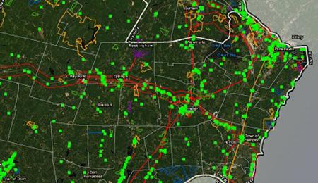
EMMIT is a publicly-accessible Geographic Information System administered by the New Hampshire Division of Historical Resources. This system gives subscribers a convenient means of accessing more than 16,000 records pertaining to the state’s historic and archaeological resources. Subscribers will have the ability to perform searches based on locational parameters as well as user-specified attribute criteria. The purpose of this system is to provide these materials to its subscribers in an efficient way, while maintaining a comprehensive archive of the statewide survey of historic properties in an ongoing initiative. The information contained in EMMIT represents the state’s sole comprehensive, up to date inventory of the state’s historic and archaeological resources
What types of resources are accessible within EMMIT?
- National Register of Historic Places nomination forms, photos and maps
- NH State Register of Historic Places inventory forms, photos and maps
- Individual Inventory Survey forms, photos and maps
- Project Area forms, photos and maps
- Historic District forms, photos and maps
- Town-Wide Area Forms, CLG grant products, technical assistance reports
- Historic American Buildings Survey (HABS) documentation
- Historic American Engineering Record (HAER) documentation
- NH Historic Property Documentation
- Archaeological site forms (restricted access)
- Archaeological survey reports (restricted access)
- Miscellaneous Reports created for or by NHDHR

EMMIT has been funded in part with federal Emergency Supplemental funding from the Historic Preservation Fund (ESHPF) through the National Park Service, Department of the Interior (DOI) as a result of Superstorm Sandy. Its contents and opinions do not necessarily reflect the views or policies of DOI, nor does the mention of trade names or commercial products constitute DOI endorsement or recommendation.
EMMIT has also been funded in part by the State of New Hampshire Conservation and Heritage License Plate Program. All funds raised through the purchase of state Conservation License Plates are used for the promotion, protection and investment in New Hampshire's historic, natural, and cultural resources.